
The Track of Potential Tropical Cyclone 9: What You Need to Know
The journey of Potential Tropical Cyclone 9 is creating significant attention as it prepares to impact the southeastern United States. The storm’s path is highly dependent on a series of complex upper-level atmospheric features, and how these factors evolve will determine its eventual landfall and potential for widespread impacts.
Key Factors Steering the Storm
Two major weather systems are currently poised to influence the movement of this storm:
- A High-Pressure System Off the Southeast Coast: This Bermuda high will play a crucial role in either guiding the storm closer to the eastern Gulf or pushing it westward.
- An Upper-Level Low in the Deep South: This sinking low could also help direct the storm’s path, with its influence potentially causing the system to drift toward the west or alter its strength.
Two Potential Tracks
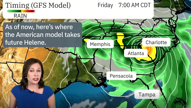
- Weaker High Pressure: If the Bermuda high weakens, it will allow Tropical Cyclone 9 to track further to the east. This would mean a path closer to the Big Bend of Florida and even as far as Tampa. This track could bring significant rainfall and strong winds to more populated coastal areas, heightening the risk of storm surge and flooding.
- Stronger High Pressure: Should the high-pressure system strengthen, the storm is more likely to veer westward, pushing it toward the Florida Panhandle. In this scenario, landfall could occur in a more sparsely populated region, though areas farther west in the Gulf could experience severe weather impacts, including potential tornadoes and heavy rain.
Likely Landfall and Timing
The storm is expected to take a path between the upper low in the Deep South and the Bermuda high. Because of this steering, landfall along the Florida Gulf Coast is likely on Thursday